
Page Randonnée et Trails en français
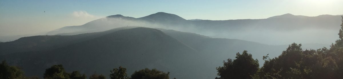
There is a huge array of walks and trail runs of all lengths and levels in the Préalpes, where we are, many of them climbing to over 1000 metres and offering panoramic views over the Mediterranean, others taking you through pretty, heritage-rich medieval hilltop villages.
If you tell us what length walks or runs you would like to incorporate into your trip, we will be happy to recommend a selection and give you all the details, so you can plan a great itinerary.
Below are just some examples of nice walks (or trail runs) which you can access either on foot from Villa Rocamar, or access easily by public bus or by car within less than half an hour. Driving 30-45 minutes opens up another 50+ great routes, both nearer the coast towards the Italian border and the neighbouring Var region, and further up into the Alps.
- Circuit du Malvan – An easy 8km loop (two to three hours’ walk). This route starts at Notre-Dames-des-Fleurs, which is 3-4km from us. You can get there easily by car or local bus, or lengthen the walk by starting from our front door (it’s a nice walk to the start point too, mostly through the forest). The loop is through the hillside above Vence and takes you past the Saint Raphaël chapel, the ruins of the Malvan village and across the little Malvan river.
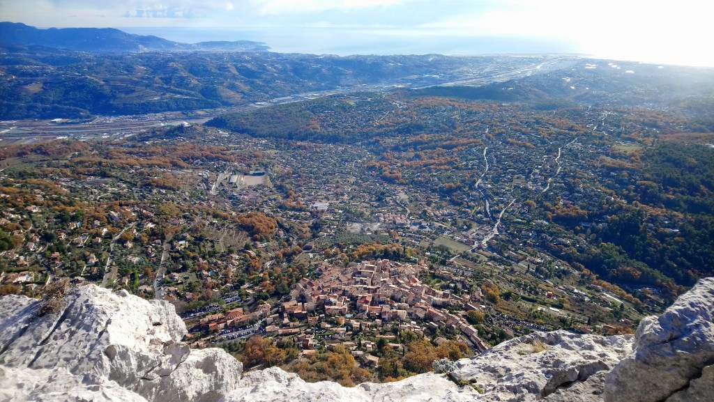
- Baous des Blancs et des Noirs – You can start from the villa, walking quiet country roads and lanes for about 40 minutes to get to the mountain trail which brings you to the summit of the Baou des Blancs (about another 40 minutes). You will climb by about 350m from the villa to the top of the first baou. From the summit, you will enjoy stunning views over the walled town of Vence and the glittering Mediterranean coastline, to Antibes, Cannes and beyond. If you feel like a longer stretch, you can head from here across a relatively flat path to the summit of the second of Les Baous, the Baou des Noirs (about another 40 minutes). The summit of this Baou offers a different perspective, looking down the deep valley of the Cagne river, the villages of St Jeannet and La Gaude, and Nice. You can retrace your steps down from here, or you even make this into a day hike by incorporating one of a number of loops around the top of the plateaux.
- Baou de St Jeannet/ Circuit du Castelet – A moderate 8km loop which climbs by about 450m, taking three to four hours to walk. It starts in the village of St Jeannet, which is 7.5km from Vence (a very scenic cycle and also accessible by bus number 47). The village is nestled at the foot of the Baou de St Jeannet, the best-known of the four limestone plateaux, because the excellent climbing on its huge karst face. You take the rue des Baous upwards from the village, which turns into a stony trail running through the valley between the Baou de St Jeannet and the Baou de La Gaude. Climbing to the summit of the Baou de St Jeannet, the route crosses the vast plateau to take you to a bluff over a small valley, where you can see the ruins of the Castelet. The descent is through the valley (of the Cagne river), passing Notre-Dame-des-Champs church to get back to the village.
- Baou de La Gaude – The furthest from us but the nearest to Nice of the four limestone plateaux, Baou de la Gaude offers lovely views over the Nice hills and the Bellet vineyard on the shore of the Var river, as well as the villages of St Jeannet and Gattières, built in perfect harmony with the mountains sheltering them. This route starts from the village of Gattières, which is 10km from us. It is a moderate 8km up-and-back route to the summit of the Baou, climbing 450m in altitude and taking three to four hours return.
- Chemin du Paradis/ Balcons du Loup – A short drive or bus ride takes you to Pont-du-Loup, where you are looking up at the stunning Gorge du Loup. You can take the Chemin du Paradis all the way up the side of the gorge to the village of Gourdon, picturesquely perched on the edge of the gorge, and back down (2-3 hours round trip). For a day hike, you can take the road and some forest trails back down to the Courmes Waterfall and from there continue along the banks of the river Loup (with several pools where you can swim) back to Pont-du-Loup (20km/ 6-7 hours).
We recommend the Randoxygène Département des Alpes-Maritimes ‘Pays côtier’ guide (in French) for more detail on some of the above and lots of other routes.

